Intergrated High Precision Rtk Gnss Surveying Instrument G972
| Price: |
US $ 3950-11500/Piece |
| Min Order: |
1/Piece |
| Pay Type: |
L/C,T/T,D/P,Western Union,Paypal |
The Best value choice-G972
Full Function High Precision RTK GNSS Receiver
The G972 is one classical high precision GNSS Receiver, which is designed & developed base on a 20-year professional GNSS products R&D experience. Deliver you with high quality GNSS Surveying System by integrating the advantages at home & abroad. We look forward to witnessing its outstanding performance together with you.
Technical Specifications:| MODEL | G972 |
| Satellites Performance |
| Channel | 220 Channels |
| Signal Tracking | GPS: L1 C/A, L2E, L2C, L5 GALILEO (Upgrade reservation) |
| GLONASS: L1 C/A, L1P, L2 C/A, L2P SBAS: WASS, MSAS, ENGOS |
| BDS: B1, B2, B3 |
| Features | Initialization time: <10s Initialization reliability: >99.9% |
| Positioning Precision |
| Static Surveying | Horizontal: ± 2.5mm + 1ppm Vertical: ± 5mm + 1ppm |
| RTK | Horizontal: ± 10mm + 1ppm Vertical: ± 20mm + 1ppm |
| DGPS | Horizontal: ± 0.25m + 1ppm Vertical: ± 0.5m + 1ppm |
| SBAS | Horizontal: 1m 3DRMS |
| Electrical |
| Power Consumption | 7.4V 3400mAh |
| Battery | Rechargeable, removable Lithium-ion battery |
| Battery Life | Single battery: 16h (Static mode), 10h (rover mode) |
| External power supply | 9-18V DC, Overvoltage protection |
| Physical |
| Dimension | 9.6cm × 18.4cm |
| Weight | 1.2kg |
| Display | 128 × 64 HD OLED |
| Communications and Data Storage |
| Bluetooth | Built - in, V2.0 Class2 |
| UHF Radio station | Built - in transceiver, 1W/2W adjustable |
| External radio | 5W/35W adjustable |
| Working frequency | 410MHz - 470MHz |
| Communication protocol | TrimTalk (Optional other compatibility protocol) |
| Network communication | Built - in WCDMA 4G network module (Optional CMDA EVDO 4G) |
| Port | 5PIN LEMO external power port + RS232, 7PIN LEMO RS232 + USB, 7PIN (RS232+USB), 2 network/radio data link antenna port |
| Key | 2. (Power supply + Multiple function keys) |
| Onboard memory | 4GB, Support for the largest 32 GB Micro SD card extension |
| Differential data | RTCM2.X/RTCM3.X/CMR/CMR+ |
| ASCII Output | NMEA0183 |
| Output speed | Maximum 50 Hz |
| Environmental |
| Operating | -40ºC ~ +75ºC |
| Storage | -45ºC ~ +85ºC |
| Humidity | Non-condensing |
| Waterproof | IP67 |
| Shock and Vibration | Withstand 2 meters pole drop onto the cement ground naturally |
| Controller |
| Model | GEODEX P9 | Getas PS336 |
| Operating system | Windows Mobile 6.5 | Windows Mobile 6.5 |
| CPU | TI Sitara AM335x 1GHz | TI AM3715 1GHz |
| Display | 480 × 640 VGA 3.7 inch screen | 480 × 640 VGA 3.5 inch screen |
| Memory | RAM 512MB, ROM4G NAND FLASH (Optional 32GB) | 256MB NAND FLASH, 8GB INAND |
| Wireless | WIFI, Bluetooth | WIFI, Bluetooth |
| Battery | 7.4V, 1500mAh | 12V, 5600mAh |
| Use time | 10h | 12h |
| Physical | Telephone digital keyboard | Telephone digital keyboard |
Function Features:
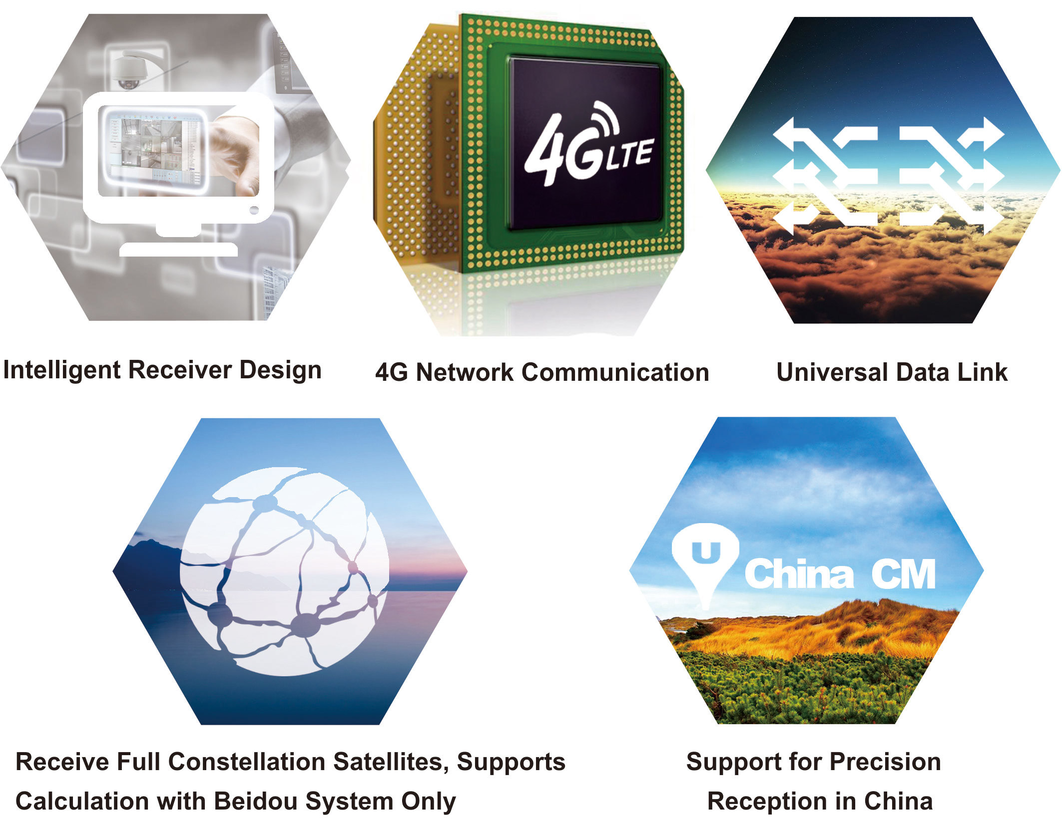 Intelligent Receiver Design: The G972 adopts the industrial ARM Cortex - M3 high performance 32-bit processor, which can perform intelligent management to each module of the receiver, Its OLED screen enables an easy Work Mode Setting among static, base station, rover station and other work mode.
4G Network Communication: G972 is built in with 4G network communication module, it provides higher transmission speed and extremely short time delay, meets requirements of big data transfers in big data era.
Universal Data Link: The radio and network transport protocol is compatible with the mainstream brand products in the market, and can work with other brand RTK Receiver for optimize the asset allocation purpose.
Receive Full Constellation Satellites, Supports Calculation with Beidou System Only: The equipment supports BDS, GPS, GLONASS system receiving, reserving GALILEO and QZSS system upgrade, and supporting the single Beidou solution.
Support for Precision Reception in China: G972 Fully functional RTK Receiver supports Ntrip mode access to China Precision System, and can provide 5 - 12 cm high precision positioning without base station and CORS. Strong Shell: The shell selects the American GE company new material, is light, strong, the penetrating ability is good.
Industrial OLED Screen Display: Industrial OLED screen, display work information intuitively. With the keys, it can easily complete the setting of the host.
Built - In Transceiver: Built - in 2W transceiver radio supports work range of 1-3KM. With external radio of 5W/35W, it supports a longer work range.
Superior Ability of Tracking Satellites: Latest upgraded full-band antenna for four - Constellations, can capture GNSS satellite signal better, this enables the G972 a more excellent performance even in a rough working environment.
Design of Large Capacity Memory: Onboard 4GB large capacity of memory, and supports Micro SD card storage extension.
Double Backup of RTK Data: The RTK Data is storaged in both GNSS Receiver, and data controller, ensure the high security and reliability of the measurement data.
Intelligent Voice Reminder: E-Survey3.0 field software has the lofting voice reminder function, intelligent guide is convenient and fast.
Double-Engine Data Link Design: Supports network & radio double - engine data link mode, double - standby, fast switching between Base & Rover work mode.
Bluetooth Automatic Reconnecting Technology: Based on the development ability of the bottom OS, realize bluetooth disconnection automatic reconnection, field efficient operation.
The Industry's Top Motherboard: Select the industry top board, high precision, strong stability, significantly shorten the time of the RTK initialization.
Full Compability with CORS: Support VRS and MAX continuous operation reference station, and support self - built CORS. E-Survey Software
Professional,intuitive and efficient
This E-Survey RTK data controller Field Software is designed & developped by the most professional software R&D engineers team, which brings you a professional, intuitive and efficient measurement of the new experience. The E-Survey software integrates construction survey, power survey, GIS data collecting in one unit. This software is compatible both with Windows Mobile and Android platform, it also supports the smart phone to be used as data controller.
1. Power Survey Line selection, cross measurement, 4-D Data Format output.
2. Road survey Road design, Middle Side Stake Layout, Cross section survey.
3. Base Map Loading Support vector data loading such as DXF, SHP and GCP.
4. GIS collection Support Attribute Data Collecting by Self-Defined data dictionary and export GIS exchange format.
5. Post Processing Software GGO Support to convert the data format into RINEX, which is compatible with AutoCAD and other Drawing & Mapping Software.
| Prod Model: |
G972 |
| Tracked Signals: |
GPS/Glonass/Galileo/Bds/Sbas |
| Rtk Accuracy: |
Plane: 10mm + 1ppm; Elevation: 20mm + 1ppm |
| Dgps: |
Plane: 0.25m + 1ppm; Elevation: 0.5m + 1ppm |
| Static Accuracy: |
Plane: 2.5mm+1ppm; Elevation: 5mm+1ppm |
| Intelligent Functions: |
Tilt Survey, E-Bubble, Voice Guidance |
| Work Distance: |
30km with External Radio |
| Radio Power: |
Internal :5W / External :35W |
| Wireless Connection: |
Bluetooth, WiFi |
| Network Communication: |
WCDMA, Support HSDPA+. GPRS, GSM(CDMA EVDO) |
| Differential Format: |
Cmr. Cmr+. Rtcm23. Rtcm3. X |
About Us
Geodex is one of the leading worldwide provider of high precision Geographic Surveying & Mapping Equipment, our main products includes RTK GPS, handheld GPS, Total Station, theodolites, automatic levels, laser level and so on.
These kinds of products are widely used for high precision measurement, surveying & mapping works, such as land & housing management, building, road, railway & city infrastructure construction, Topographic, Cadastral, monitoring and mining, hydro & marine surveying projects.
Geodex's office & factories are based in China. Its head office is located in Guangzhou, and main factories are located in Guangzhou & Beijing.
Geodex's main customers are geographic surveying information departments and construction companies, its products are also sold to Colleague & University for teaching uses.
Geodex sells products to many different countries. It has a high market reputation because it not only provides high quality products, but also excellent customer & technical supports.
Mission Statement
Make A Difference by Delivering Surveying Equipment to All Over the World
Our mission is to help our clients to be more competitive and achieve more business success.
Packaging & Shipping
Geodex has excellent performance in providing Oversea Transportation Solutions. Goods would be arranged to send by Express Courier door-to-door delivery service like DHL, FedEx, UPS, TNT and so on or General Air Cargo Service from airport to airport, shipment by ocean (boat), by truck via land transport or special line service forwarder agent appointed by buyers.
About Technical Supports
1) We provide not only high cost-efficiency surveying instruments,
2) but also professional surveying solutions and strong technical supports including maintenance & parts service.
3) Make sure Quality Verified & recalibrated before each shipment.
4) Fast Delivery, stocked in Guangzhou.
5) Professional Export & Import Service.
6) One-year warranty period of surveying equipments.
Contact
Guangzhou Geoland Instrument Co., Ltd.
Add: D5-410, Minjie Squre, Shuixi Road, Huangpu District, Guangzhou, 510530, Guangdong, China
TEL: +86 (0)20-8251 6799 FAX: +86 (0)20-8251 6499
Website: http://www.geodexsurvey.com
------------------------------------------

